It’s axiomatic that unmanned aerial vehicles will be the wave of the future. From shooting photos and video, to surveillance, to the delivery of goods, so-called drones are expected to generate as many as 100,000 new jobs by 2025.
Many BSU departments are doing their part to ensure that the university and its students are ready for the future; some even own and operate drones on campus.
One such entity is the GeoGraphics Lab. Located on the fourth floor of the Dana Mohler-Faria Science and Mathematics Center, the lab’s co-directors, Professor Uma Shama and Larry Harman, ’63, have been using UAVs of one sort or another since 2001.
The pair spent the late spring and summer using two different drones to take photos of the campus and the surrounding area and applying aerial imagery analysis to the results. Thanks to BSU’s wireless internet coverage, video from drones can also be live streamed for real-time monitoring. The work was intended to find out how drones can help the university monitor such things as traffic issues to energy use.
This technology holds great possibilities, Mr. Harman said. Which is why he and Dr. Shama are proposing to turn the campus into a “living lab,” where safety, efficiency, effectiveness and general infrastructure management can also be monitored from above.
“This changes the game as to how you do this,” Mr. Harman said. “You can monitor the campus’ roads in real time, and learn how you can improve maintenance and operation of the transportation infrastructure.”
Safety concerns can also be addressed with the extra sets of eyes in the sky that drones can provide when needed.
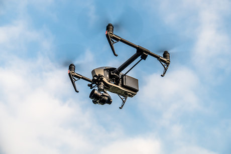
The advent of readily available and relatively inexpensive drones with excellent flying and remote sensing capabilities makes these kinds of endeavors possible.
Mr. Harman and Dr. Shama have worked with Facilities Maintenance and Planning to identify safe launch-landing zones on campus that will allow the drones to provide photos and video of key areas where cars and human traffic flow and/or converge. Through the use of drones, real-time viewing can also be done of parking lots, the solar farm, storm damage, areas of water runoff, and just about anything outdoors that needs to be monitored and measured for efficiency and efficacy. When there’s an emergency, UAVs and the views they can provide can help emergency workers identify and assess threats and find possible solutions.
The GeoGraphics Lab is working with the BSU police and several academic departments, including aviation science and geography on the initiative. They are also developing a course to teach students about the potential UAVs hold and to train them for the necessary licensure exam.
An event titled “Drones Doing Good: A workshop applying small unmanned aircraft systems to infrastructure management in Southeastern Massachusetts” has been scheduled on campus for Dec. 15, that will be open to the public. It will be of particular interest to regional planning and transportation agencies and municipal workers. (Story by John Winters, G ’11, University News & Media)